It’s time to talk about Hurricane Sally. And, I believe the best place to start that discussion, because that storm was such a shock to many lifelong sailors in Pensacola, is with the forecast. After Sally ripped through, so many people asked Phillip and I—along with I’m sure just about every other boat owner in Pensacola: Why didn’t you leave? Why didn’t you haul? Why did so many leave their canvas up? I even overheard a guest at a restaurant overlooking the wreckage of our once-beautiful Palafox Marina ask her friend: “Why didn’t they just go out in the Bay and ride it out there safely?”
‘Ride out’ 15-foot seas and 120+ mph winds pushing you to shore … and do it … safely? Psshh!
But, I understand people who do not own a boat or who do not sail or cruise, simply don’t understand a few unfortunate truths about marine weather forecasts and storm prep:
- A forecast is just that, a prediction, an estimate. Nothing is truly certain until 24 hours out.
- The decision to haul must be made 3-5 days in advance, when nothing is certain.
- Moving the boat in the last 24 hours is dicey, dangerous, and no guarantee.
Why? Because hurricanes are generally a few hundred miles wide, traveling on unpredictable paths. Even if you think you should move the boat in the final hours, deciding which direction to go is incredibly difficult. And, most sailboats can only go 5-7 mph, at their top speed, which requires the winds and seas be favorable (conditions in a storm are rarely favorable). Sailors can’t get anywhere fast, much less travel the likely hundreds of miles it might take to get out of the cone of uncertainty, which is constantly shifting anyway. But, the cone and the NOAA forecasts are the best predictions we have to go on. In our opinion, even if you are in the cone of uncertainty, choosing to leave the dock to sail in a storm when you don’t have to (i.e., when the only goal is to save the boat) is just an unnecessary bodily risk.
While I’m on the topic, I’ll include a word about NOAA’s cone of uncertainty, a bit of which I learned myself in researching to write this piece. The cone (sample below) represents the probable track of the center of a tropical cyclone and is formed by enclosing the area swept out by a set of circles (NOAA has calculated over decades) along the forecast track (at 12, 24, 36 hours, etc.). The size of each circle which forms the cone is set so that two-thirds of historical official forecast errors over a five-year sample fall within the circle. The cone has been enlarged over the years to reduce the error rate. Thus, despite the name of the cone, its highly calculated and time-tested goal is to be as certain as possible. You can learn more about NOAA’s Cone of Uncertainty here.

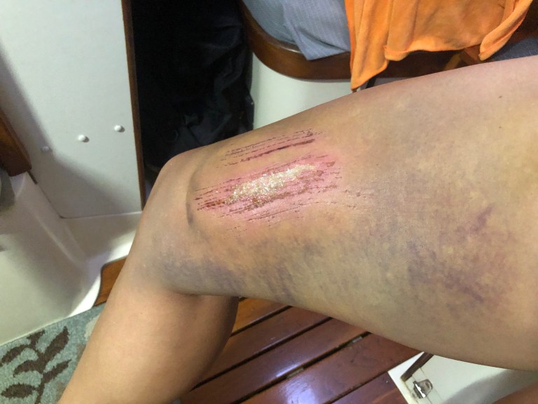
Unfortunately, NOAA’s prediction for Hurricane Sally in the final days before the storm was the most inaccurate many of us sailors in Pensacola can remember. We were never encouraged to leave our marina, under even a voluntarily evacuation or a mandatory one, which is very telling. We had several boats in our marina who had travelled in the 3-4 days before the storm from Louisiana east to our marina in an effort to get out of Sally’s expected path. The bottom line is, Hurricane Sally just stunned us all. No one expected it to come to our shore, our marina, with such ferocity until it was simply too late. It wasn’t until within 12 hours of her vicious landfall that we realized where her sights were truly set and that we were about to be hammered by her most unforgiving northeast quadrant. What was an expected tropical storm brought us 120+ mph winds in our marina and 15-foot waves in the Bay crashing over the marina seawall. It was an attack the boats and docks in the marina simply could not withstand.
I write this to share with you all and let you see what Phillip and I, along with virtually every other boat owner in Pensacola (many now devastated by the loss of their beloved girls), saw as Sally approached. This was our weather timeline in the days before the storm:
Friday, September 11:
Sally is a tropical depression only, rolling over the southern tip of Florida. She is predicted to turn into a tropical storm in the Gulf and go straight toward the Mississippi-Louisiana border. If Phillip and I are going to haul Plaintiff’s Rest out for Storm Sally (which NOAA did not predict at any point to become a hurricane), this is the day it is offered under our hurricane haul-out plan. The option is: confirm we will haul tomorrow or stay in the water. As our most extreme measure for protecting the boat from a storm, hauling out is something Phillip and I are inclined to do only when there is a likely threat a hurricane will make landfall. As that was not the forecast at the time, we decided to stay put.

Saturday, September 12:
At this time, Storm Sally is predicted to become a Cat 1 hurricane and strike the LA-MS border, almost 200 miles to the west of us, on Tuesday evening. Pensacola is in the far east edge of the cone of uncertainty and is under a tropical storm watch (not warning) only. A Tropical Storm Watch is issued when sustained winds of 34 to 63 kt (39 to 73 mph) or higher associated with a tropical cyclone are not certain but possible in 36 hours or less. You can learn more about the National Weather Service’s storm warnings here.

Sunday, September 13:
Storm Sally is still on track for the LA-MS border as a Cat 1, showing a hook to the east after she makes landfall. At this point, Pensacola is entirely outside the cone of uncertainty. The city is under a tropical storm warning. In increasing from a Watch to a Warning, the National Weather Service changes the prediction from a possibility of tropical storm conditions to an expectation. Meaning, at this time, we are to expect winds of 34 to 63 kt (39 to 73 mph) or higher that may be accompanied by storm surge. Some boaters expect we might get winds of 40-50 knot winds in the marina, perhaps. Phillip and I spend the afternoon taking down the dodger and tying additional lines. We leave our bimini on as the marina typically shuts power down for a storm and we wanted to make sure the bilge pumps could perform in case the unexpected happened. Our head sail is already down. We secure the halyards and the main sail in her stack pack. We fasten chafe guards on our additional lines and help other friends in the marina prep their boats for an expected tropical storm. Although Palafox Marina is notorious for urging owners to leave the marina with just the slightest hint that a storm may come (they are very conservative in their weather predictions, with a strong desire to evacuate in the event of a possible storm to preserve the docks), we receive no encouragement to leave, not even a request for voluntary evacuation.

Monday, September 14:
Storm Sally is still on track for the LA-MS border, predicted to hit as a Cat 1 and then hook to the east and travel to the north of us heading northeast. Pensacola is just outside the cone of uncertainty and under a tropical storm warning only. No additional prep is undertaken as we are expecting only heavy rains and winds of potentially 30-50 knots in the marina, at most. Several feet of storm surge is expected but does not worry us as we are on floating docks.

The wind prediction for Monday shows a 50-60% chance of winds between 35-74 mph (tropical storm) in Pensacola.

Tuesday, September 15:
Sally slowed down considerably over Monday night and is now crawling at 2 mph, no longer moving on her predicted track toward LA but sitting in more of a stall pattern in the Gulf. The 4:00 p.m. NOAA forecast was the one made every boat owner’s stomach in Pensacola drop like a seventy-pound stone.

The rapidly-changing forecast has us all concerned that this storm may come with much more force than we had anticipated. Sally was now predicted to hit as a hurricane on the MS-AL border followed by a sharp turn to the east. For the first time since Sally’s development, Pensacola is put under a Hurricane Watch, which means hurricane force winds in excess of 74 mph are not simply possible but expected. Hurricane Sally was then 250 miles wide poised to strike anywhere from Gulfport, MS to Fort Walton Beach, FL, a span of 180 miles.

Everyone was worried. Many boaters were calling each other, texting, asking if they should tie more lines, do more prep, try to move the boat, bury their heads, pray, puke, cry?! Pensacola only had a few hours of daylight left with no place any sailboat owner could safely move their boat to in that timeframe. In addition, many of us have to travel in the Gulf to go east (because of bridge heights), which wasn’t even an option with Sally out there churning. With fifteen-foot tall waves that came to our marina early the next morning, we can only imagine what ferocious conditions would have awaited any sailor in the Gulf at that time. Winds in excess of 80 mph? Waves twenty-five feet tall? Whatever the condition, it was not a situation many of us could or would put ourselves in in order to move our boats east. The marina did not issue an evacuation order Tuesday evening as it was simply too late. When the Tuesday 7 pm advisory was issued, it was clear: Hurricane Sally was coming, and we were all tied in our slips and locked in her path.